
Welcome to Roadview, an online blog and gallery where I share experiences and photography from my many road trip adventures. Additionally, I will be showcasing various creative photography styles in the 'Just for Fun' gallery. So, grab your favorite road trip snacks, buckle up and let’s get rolling!
South Window, Arches National Park
The Mighty 5 National Parks are in the arid, red rock country of southern Utah. They are Arches, Canyonlands, Capital Reef, Zion, and Bryce Canyon. This region stands out as one of the country's most breathtaking areas and is ideal for a road trip—or even multiple trips—given the abundance of sights and activities available. I explored these parks, and more, on two separate occasions. The first road trip, in April 2022, included visits to Arches, Canyonlands, and Capitol Reef National Parks, with a mandatory stop at Monument Valley, and several other locations.
I started my journey in Salt Lake City and drove for 3.5 hours to Moab, as I was visiting the eastern region of Utah first. With Arches and Canyonlands close by, plus hotels, restaurants, and shopping, Moab is the perfect home base. If your hotel doesn't provide breakfast, there are numerous excellent choices to fuel up for a morning hike.

Mesa Arch, Canyonlands National Park
Things to Consider
Here’s a checklist of somethings to consider before heading out-
Vehicle-a standard car is fine, but an SUV or 4x4 will get you to more places.
Timed Entry-some national parks have timed entries to keep congestion down, like Arches. Use the recreation.gov app to book your entry($2). Parks are open 24 hours for some nice stargazing opportunities!
Crowds-summer months are busy times. Travelling in Spring and Fall have limited crowds, more available accommodations, and cooler temperatures.
National Park Pass-yearly pass is $80, entrance fees around $30, so pays for itself quickly. Seniors over 62 can purchase an Annual Senior Pass for $20 or a Lifetime Senior Pass for $80 with unlimited park access.
Elevation-parks range from around 4.000’ to 9,000’. Coming from sea level and lower elevations you may experience some side effects.
Weather-Spring and Fall usually mid to high 60’s with nighttime low to mid 40’s as an average. I’ve been lucky with lots of sun and few clouds!
Clothing-layers is always good and remember a hat and sunglasses. Wide brim hats and upf clothing are items to consider.
Lots of Water!
SUNSCREEN-a broad spectrum 30 spf or higher to protect your skin!
The Mighty 5 Itinerary

Turret Arch, Arches National Park
Itinerary, what?! These are general rules on a road trip from Alaska-
Usually a 2-week trip
A general direction that makes sense
hotel arrangements for the first night only
From there be free and spontaneous
That’s it, easy peasy!

Sunrise from my balcony, Monument Valley
Arches National Park
Designated 1971 Elevation 3960’ to 5653’

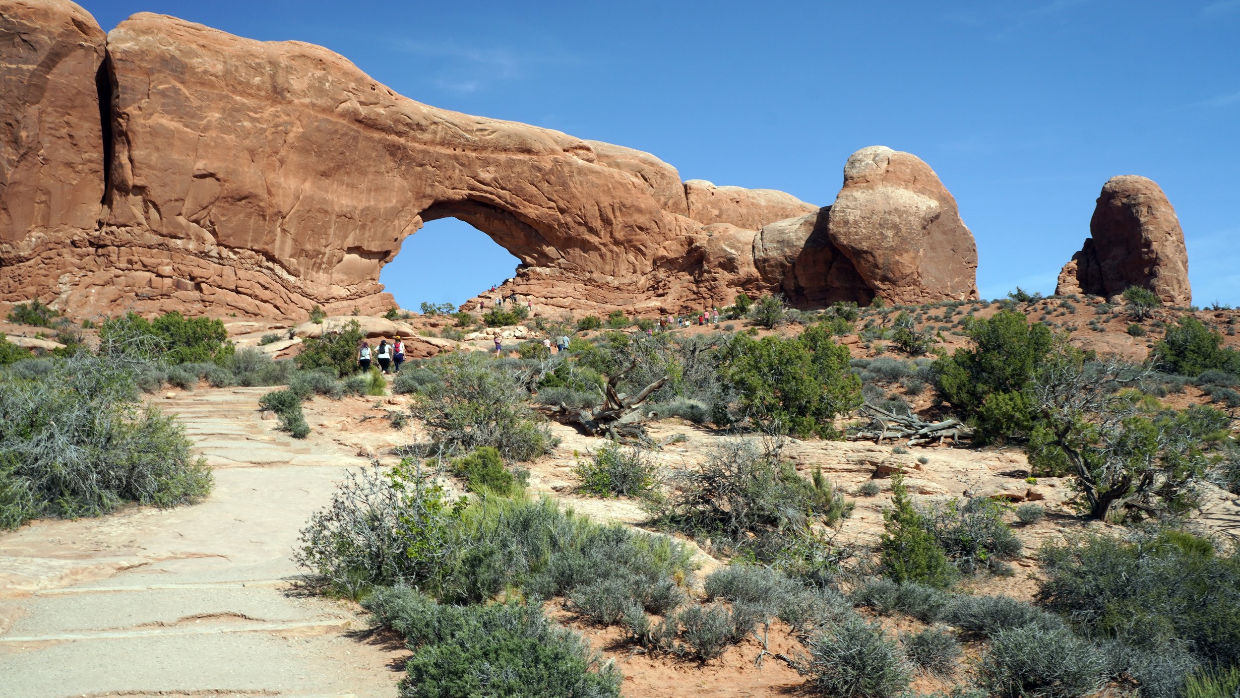
North Window, Arches National Park
Arches is a smaller park and can be seen in 1-2 days with arches, fins, balanced rocks, red sandstone walls, and lots of easy to moderate hiking. The sandstone takes on different hues depending on the time of day and set against a bright blue sky can be breathtaking!
I made it to the park before sunset after a long day of travel and huffed and puffed my way up to see Delicate Arch. At 52 feet tall and standing alone, it seemed as though it could topple over, particularly with the wind being so fierce that evening! The Wind (more on this later)! I awoke the next day feeling lightheaded and dizzy. I was definitely feeling the elevation and I had had a covid shot before I left that was messing with me, too. However, I made it to my noon entry time and enjoyed hiking and seeing some amazing arches before sunset, leaving me wanting more!
Other things I saw in the park
Park Avenue- a nice hike with towering sandstone walls
North and South Windows- with nice panoramic views
Turret Arch- a free standing arch that looks like a remnant of a castle
The Fins- eroded fractured rock forming thin sandstone walls
Broken Arch- a nice stroll through a meadow like area with nice views of the fins
Sand Dune Arch- located in the fins, very sandy and cooler temperatures

The Fins, Arches National Park
Shiprock, New Mexico
Elevation 7,177’

Shiprock with some of the “wings”, New Mexico
Shiprock is the neck of an extinct volcano called a monadnock about 40 minutes west of Farmington. It rises 1583’ above the plain and 7,177’ above sea level. Very impressive! Shiprock, known as 'Rock with Wings' to the Navajo, is situated on sacred land, and close access requires permission. Although it is easily accessible to photography from the road and a small gravel parking area. The “wings” are ancient lava walls or dikes being gradually exposed over time form erosion. The main wall stretches to the road and beyond. Shiprock is so dominant that it can be seen from miles around. My first glimpse was from 35 miles away while visiting the Four Corners monument!

The “wings” of Shiprock, New Mexico
Valley of Dreams, New Mexico
New Mexico Badlands
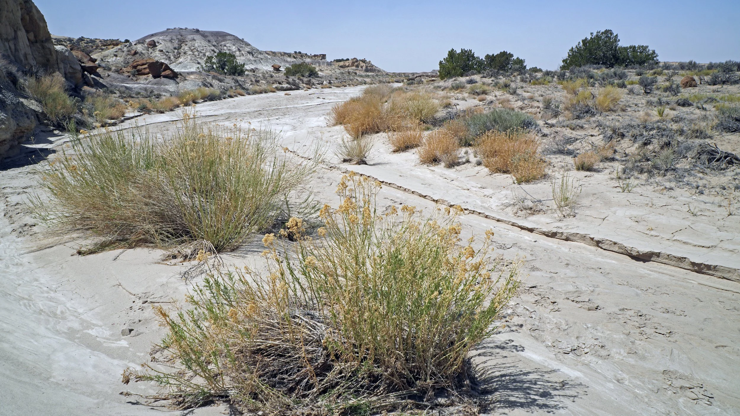
The Ah-Shi-Sle-Pah Wilderness area in northwestern New Mexico is otherworldly with its dry, sandy, moonscape like terrain. Full of hoodoos and other rock formations it was definitely a place I needed to check out. There are two parts to explore, The Bisti, and The Valley of Dreams. This visit was for The Valley of Dreams. Getting here can be challenging which limits its accessibility, but I was determined. Heading south from Farmington I turned right onto a gravel road that look passable, so I pushed ahead. After several miles I pulled into a parking area, not sure this was the right place, but I parked, fed a friendly dog a piece of cheese, and headed down a sandy path. Walking down I made mental notes of a few natural landmarks so I could find my way back, there were also some cairns marking the end or beginning of the trail. It was a beautiful sunny day for a walk through this unique place. It was, however, windy! Now, I came to see a unique hoodoo called Alien Throne. Remember the Xenomorphs in the Alien movies? I always think of the Alien Queen perched upon her throne here. As this is an ancient seabed there is petrified wood and dinosaur remains here, as well. Anyway, after hiking for a while I realized that I wasn’t in the right place and decided to hike back to the car and go further down the road. On my way back and after getting a little disoriented, scary, I got an alert on my phone that a sandstorm was heading my way and would last about an hour! What, it was a clear beautiful day! Then I turned around and saw it. A sandy brown cloud over the horizon and heading my way! Well, there was nothing I could do but keep moving, knowing that it would engulf me at any minute. And it did! As I was hiking up to the car it came from my right, I learned later there were gusts to 60 mph, I pulled my shirt collar up around my neck and used my wide brimmed hat to shield my face. I got to my SUV and wondered if I should drive. The wind was going to be behind me, so I went for it and made it back to the main road where I turned left which meant the wind was pushing me sideways. I had now passed two trucks on their sides! I drove on slowly and made it back to my room. The storm lasted 5 hours with air quality index of 500!!! What a memorable event! Needless to say, I did not get to see Alien Throne, yet am determined to return. Next time I may use a tour company and let them do the driving! :)

Hiking through here I found petrified wood!
Monument Valley Navajo Tribal Park
Created 1958 Elevation 7096’

Along the 17-mile road, Monument Valley.
Monument Valley is one of, if not, the most iconic spot in the western United States. Highly photographed and used as a location for many old western movies like Stagecoach, a 1939 movie starring John Wayne that made it famous. You might recall the scene of Forrest Gump running along Highway 163 in the movie, completing his ultra-marathon. Mainly it’s known for its breathtaking and iconic buttes, some reaching as high as 1,000 feet, slender spires, other vast sandstone structures, and the beautiful white puffy clouds.
Consider staying at The View Hotel, where each room offers a view of the buttes, and take the 17-mile scenic drive for an intimate experience of this wonderful place. It's sure to be a memorable experience!

Totem Pole and Yei Bi Chei (Sacred Night Dance)
Canyonlands National Park
Designated 1964 Elevation 4,000’ to 6,000’

Canyonlands Overlook
Canyonlands is in 4 parts-Island in the Sky, The Needles District, and the Maze, plus the rivers. Island in the Sky is the most visited, The Needles are a little more remote yet accessible, and the Maze is by permit only. Canyonlands is an immense expanse of sandstone canyons, buttes, and spires created partly by erosion from the Colorado and Green rivers with amazing overlooks, lots of hiking, and stargazing. Designated a Gold-Tier International Dark Sky Park in 2015!
I visited the Island in the Sky which is a magnificent 1,000’ mesa with amazing views from several overlooks such as Shafer, Green River, and Grand View and there are several hiking options, mostly easy to moderate, along the 17-mile scenic road. One of the hikes I did was Whale rock which is a giant sandstone formation that looks like a beached whale. It’s a moderate hike with great views of the surrounding area, like Upheaval Dome (image below) that is a unique feature that has yet to be fully explained. Some think this 3-mile wide, 1,000’ deep crater was created by a meteor impact, and others the erosion remains of a salt dome. Either way very impressive! You will know why Canyonlands got its name when you reach the end of the scenic road at Grand View Point. Spectacular!
Close by Canyonlands is Dead Horse Point State Park. It was late in the day, but I did manage to get a few shots. It’s definitely worth another visit!

Upheaval Dome, Canyonlands NP

Dead Horse Point State Park Panoramic, Utah
Goblin Valley State Park and Little Wild Horse Canyon
Utah

Goblin Valley State Park, Utah
After leaving Canyonlands I drove north to Green River and then south on Highway 24 towards Hanksville. Along the way is Goblin Valley State Park and Little Wild Horse Canyon, a couple of terrific sites often overlooked on a Utah road trip. Goblin Valley is an otherworldly place with 3 square miles of “goblins” that look like mushrooms, gnomes or anything else you can imagine. I took off and made my way in and around them, yet there are a few trails you can take, as well. It’s such a cool and unique place!
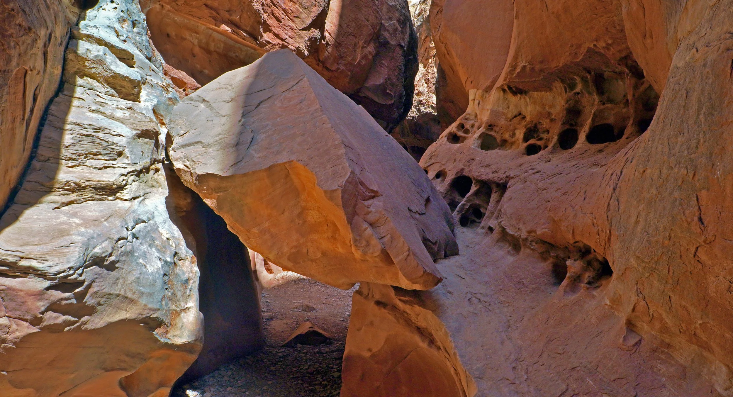
Little Wild Horse Canyon is a free slot canyon just a few miles from Goblin Valley. It was my first slot and I’m hooked! It’s known for its sculpted walls that can reach 200’ tall. There were tight squeezes, some rock scrambling, and even a water obstacle. I got wet! What a Blast!
So, if you get to southcentral Utah be sure to check these two places out!
Little Wild Horse Canyon
Factory Butte, Utah
Elevation 6,302’

Factory Butte, Utah
In the Upper Blue Hills of Utah is the Caineville Badlands that features an amazing sandstone peak called Factory Butte. The area is rugged and weathered with shades of blue, purple, and gray. Desolate and yet beautiful. My kind of place!
Factory Butte is BLM land which is open for all to enjoy. You can hike, bike, camp, and use OHV’s. And in spring this dry badland area can come alive with wildflowers!
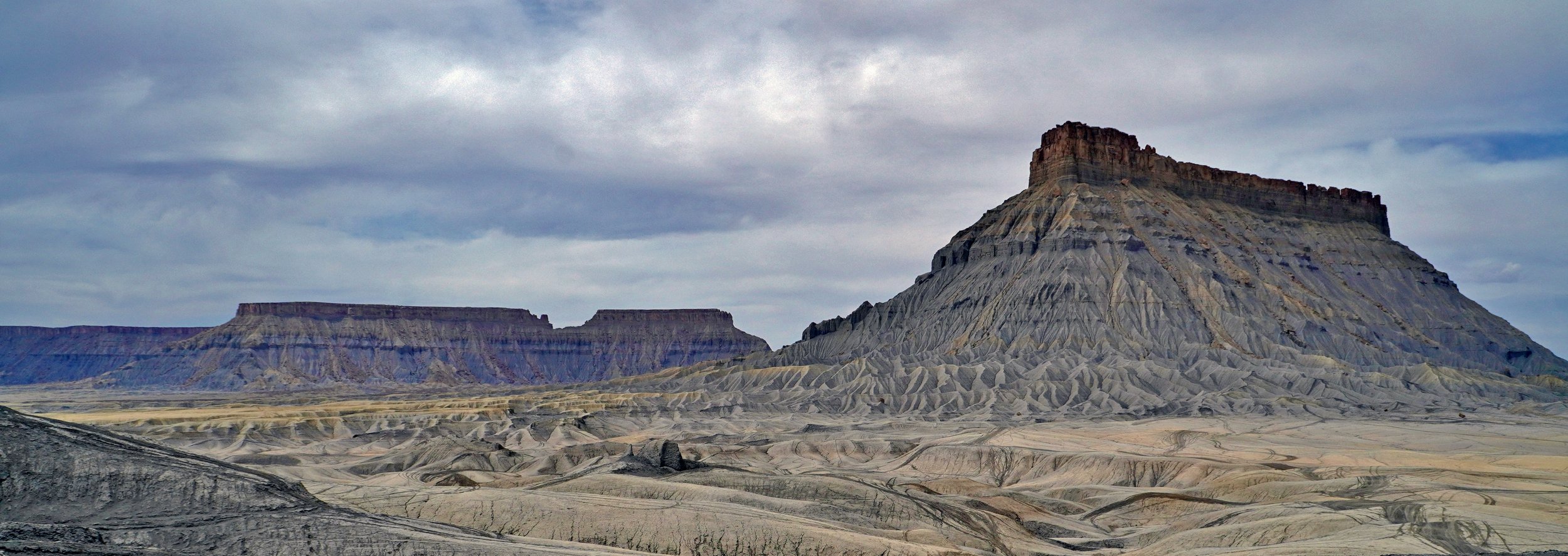
Factory Butte, Caineville, Utah
Capital Reef National Park
Designated 1971 Elevation 3,875’- 8,800’

Upper Section of the Waterpocket Fold, Capital Reef National Park
Capital Reef is a beautiful national park rich in history and known for its geological landforms. The park was named for the white domes of Navajo Sandstone that resemble our capital buildings today. The main feature of the park is the Waterpocket Fold, a 100-mile buckle in the earth’s surface that creates a step up of its many rock layers. Erosion forms depressions, known as "waterpockets," in sandstone that collect water.
There are some great hikes in the park like: Hickman Bridge that is 125’ tall and 133’ across, The Grand Wash with its 500’ walls of sandstone, and Capital Gorge a passageway through the Waterpocket Fold from where early settlers migrated. Many varieties of fruit trees were planted by early settlers in the Fruita Historic District and each year you can purchase delicious pies from the Gifford Homestead store from March 14 - October 31.
Capital Reef is underrated compared to the others of the Mighty 5 based on the number of visitors it has each year, which makes it more enjoyable. Other than the Fruita District and Scenic Drive there is the southern portion with great views of the Waterpocket Fold, and the northern portion is called the Cathedral District with its tall sandstone monoliths. The driving in both areas can be sketchy so it’s a good idea to check road conditions at the visitor center.
All in all, the couple days spent here in mid-April were beautiful and sunny. And like the other parks I’m looking forward to exploring more other areas of Capital Reef National Park.

Large Sandstone Hoodoo, Cohab Trail, Capital Reef National Park
Just for Fun

Salmon Poppy
While capturing the beautiful landscape along the road is something I love, I also enjoy photographing flowers and like finding interesting ways to display them. The current gallery's close-up shots enable the flowers to burst off the screen in a vibrant manner. Enjoy!

Pink and Yellow Dahlia
Final Thoughts on Utah’s Mighty5 - Part One

Capital Reef National Park
And there you have it, a road trip of experiences that will last a lifetime in three of Utah’s Mighty 5 National Parks. I hope you found the journey enjoyable as well, and I invite you to stay tuned for part two. If you would like to add anything or share your experiences leave a comment below. Cheers!
Be You - Go Live
Mel